
Fishkill Creek Watershed - Introduction
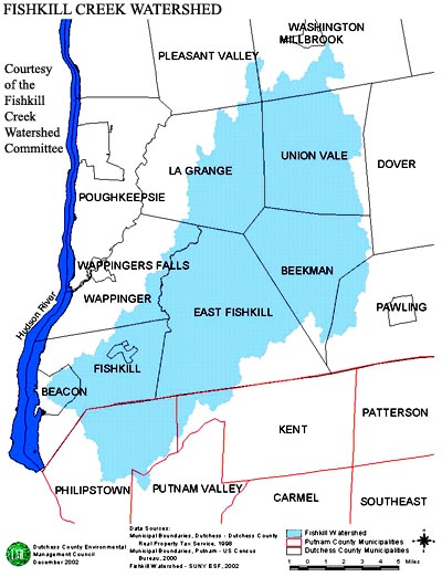
The Fishkill Creek basin covers approximately 194 square miles. Fishkill Creek, the basin’s primary stream, begins in the center of Unionvale. From there it flows southwest, entering the Hudson River at Beacon. It drains a large part of Unionvale, Beekman, East Fishkill, Fishkill and part of Pawling. Sprout Creek, Fishkill Creek’s primary tributary, drains major sections of Lagrange and Unionvale and small portions of Wappinger and East Fishkill. The watershed also extends into Philipstown and Kent in Putnam County.
The creeks in the Fishkill basin drain comparatively fiat farmland and wetlands. In the upper reaches of the basin the stream drops slightly more than 200 feet in 10 miles. In the lower portion, where Fishkill Creek falls over slate and limestone ledges, the gradient is 200 feet in 5 miles. Most of the Fishkill Creek is 1 to 2 feet deep and less than 50 feet wide during periods of moderate flow.
The Fishkill Valley is primarily underlain by dolostone and limestone of the Wappinger Group. The sand and gravel aquifer of the Clove Creek and Fishkill Creek valleys is one of the most prolific aquifers in the Fishkill area. Much of the Fishkill Basin water supply comes from private and town owned groundwater well systems, which draw from this aquifer. Because of the dependence on groundwater by municipal systems, watershed protection is extremely important in the Fishkill Basin. Public water supplies for the Fishkill Basin area are located in part of LaGrange, Union Vale, a small part of Wappinger, Beekman, Fishkill, and East Fishkill.
Most of the streams, rivers, lakes, and ponds within Dutchess County are Class B, C, or D, allowing bathing, fishing, and boating, secondary contact recreation, respectively. In the Fishkill Basin, streams and lakes classified as “A” suitable for drinking water include Fishkill Creek and Tributaries of Cargill Reservoir.
The Fishkill Basin encompasses the fastest growing towns in Dutchess County. From 1970 to 1990, the population of Beekman, East Fishkill and Fishkill grew by 84%, 100% and 111%, respectively. As a result, throughout the watershed suburban development has reduced buffer zones along stream and river corridors. As more development takes place there is less land to absorb water to replenish the water supply. In addition, increased runoff from paved areas occurs with the potential of carrying pollutants into the ground. Ideally, soil filters the pollutants out of runoff. When there is excess runoff the soil becomes saturated and the water runs directly to the surface water bodies. Most pollutants need a minimum of soil depth to achieve filtration. When this clearance to ground water is not achieved ground water aquifers are contaminated, threatening our water supplies, and our health.
We are a volunteer, non-profit, non-advocacy group. Click
here to see our policy. Our mission is to encourage
individuals and entities, both public and private, to work for the
protection of the natural environment within the Fishkill Creek
Watershed.
Mission
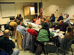 Open to the public.
2nd Monday of the month, East Fishkill Library,
Rt. 376, next to Town Hall, 7-9 pm.
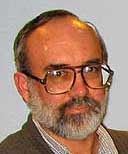 Rick Oestrike
See the
Introduction by member Rick Oestrike in the Poughkeepsie
Journal.
(opens in a new window)